Refugees crossing Mediterranean Sea (2000-2016)
The world is facing the most significant migratory crisis in its history. Even of this very day, millions of refugees are scrambling to reach the EU after fleeing war-torn countries such as Iraq, Syria and Libya. According to the International Organization for Migration (IOM), around 35,000 of them died or went missing between January 2000 and September 2016. The majority of deaths were due to drowning or exhaustion. In 2015, 1 million of refugees tried to cross the Mediterranean—more than 3,770 were reported to have died. The “Deadly crossings to Europe” project consists of an interactive map that graphically represents (and locates) the dead and missing refugees who have crossed the Mediterranean over that period (2000-2016)—detailed information is available by clicking on each dot. This webmap also shows the major routes they have taken, the main international migration hubs, and the most populous refugee camps—the leading host countries for refugees are identified in the background. The first objective of this project (encouraged by the International Organization for Migration—IOM) was to make everyone clearly aware of this large-scale human tragedy. In addition, my aim was to encourage selfless action (emanating from different public and/or private actors). My deep intent was to foster local community initiative that provides assistance to the refugee and immigrant populations in Europe. To do so, I did not want to steer/channel action, to promote specific health or social assistance, for instance, or to direct the public to any specific NGOs. I rather sought to encourage the public to move forward constructively by finding their own way to support these migrating families who have risked their lives in search of a better future (towards constructive involvements); in other words, I were seeking to transform sudden ‘bursts of conscience’ into concrete altruistic behaviors and acts (in favor bottom-up actions). Data visualization has the ability to influence and persuade its audience (for better or worse). This refers to a certain ‘cathartic’ power, closely tied to its inherent educational capacity and amazing incentive effect. Data designers (like any other) have an ethical responsibility to contribute to building an equal, harmonious and more human world. With this project, I hope to modestly contribute to this immense task, and in doing so act responsibly.
Le monde fait face, depuis les années 2000, à l’une des plus importantes crises migratoires de son histoire. Des milliers de personnes réfugiées nourrissant l’espoir d’une vie meilleure tentent, aujourd’hui encore, de gagner l’Europe échappant aux conflits armés en Iraq, en Syrie ou encore en Lybie. Selon l’Organisation Internationale pour les migrations (OIM), 35000 d’entre eux furent portés disparus entre janvier 2000 et septembre 2016—noyades, morts de froid, d’épuisement (etc.), les causes seraient multiples (plus de 3770 décès ont été enregistrés/recensés de source sûre). Le projet de visualisation de données intitulé « Deadly crossings to Europe (Mortelles traversées vers l’Europe) » propose de cartographier [de localiser sur une carte interactive] ces nombreuses disparitions, soit celles des réfugiées-migrants-déplacés en provenance des pays d’Afrique, du Proche et Moyen Orient ayant parcouru terres et mers (entre 2000 et 2016) en vue d’atteindre le continent européen. Chaque point de couleur présent sur la carte représente, selon son diamètre, une ou plusieurs de ces disparitions humaines (personne[s] décédée[s] et/ou portée[s] disparue[s])—des informations détaillées (contextes, faits, évènements relatifs) sont disponibles au clic sur chacun des points et symboles. Les routes/voies les plus empruntées y sont tracées, les principaux carrefours et refuges également matérialisés graphiquement. L’index des différents pays d’accueil est, quant à lui, traduit au travers de calques cliquables recouvrant leur géographie et variant en niveaux de gris selon leur rang (cf. légende). L’objectif premier de ce projet (encouragé par l’agence intergouvernementale OIM) est de faciliter la prise de conscience tout à la fois morale et intellectuelle de cette tragédie de très grande ampleur ; par là, revient-il, en outre, d’inciter à l’action (comme au soutien de l’action) humanitaire, à l’initiative solidaire tant individuelle que collective de quelque nature qu’elle soit. Un second objectif est d’attirer l’attention des publics sur deux réalités majeures lesquelles, pour être tout à fait confirmées-validées-authentifiées, appelleraient encore bien des études et recoupements de faits. La première est que les ‘frontières’ de l’Europe, plus précisément celles délimitant l’espace Schengen, apparaissent telles des lignes infranchissables, indépassables pour ses navigants ayant traversé les mers Méditerranée, Egée et Ionienne (notamment) au péril de leur vie. La seconde des réalités a trait à l’effroyable récurrence ou répétitions d’événements funèbres. En effet, il peut être observé sur la représentation cartographiée qu’entre 2000 et 2016 plusieurs embarcations ont sombré ou disparu en mer à des coordonnées géographiques relativement proches, voisines : ironie macabre de l’histoire ou « crime d’indifférence » (terme que j’emprunte ici à André Glucksman) ? Nul ne saurait le dire probablement. Reste que l’incompréhension et l’écœurement demeurent, bien au-delà de tout.
URL: http://www.davidbihanic.com/refugees
Screenshots

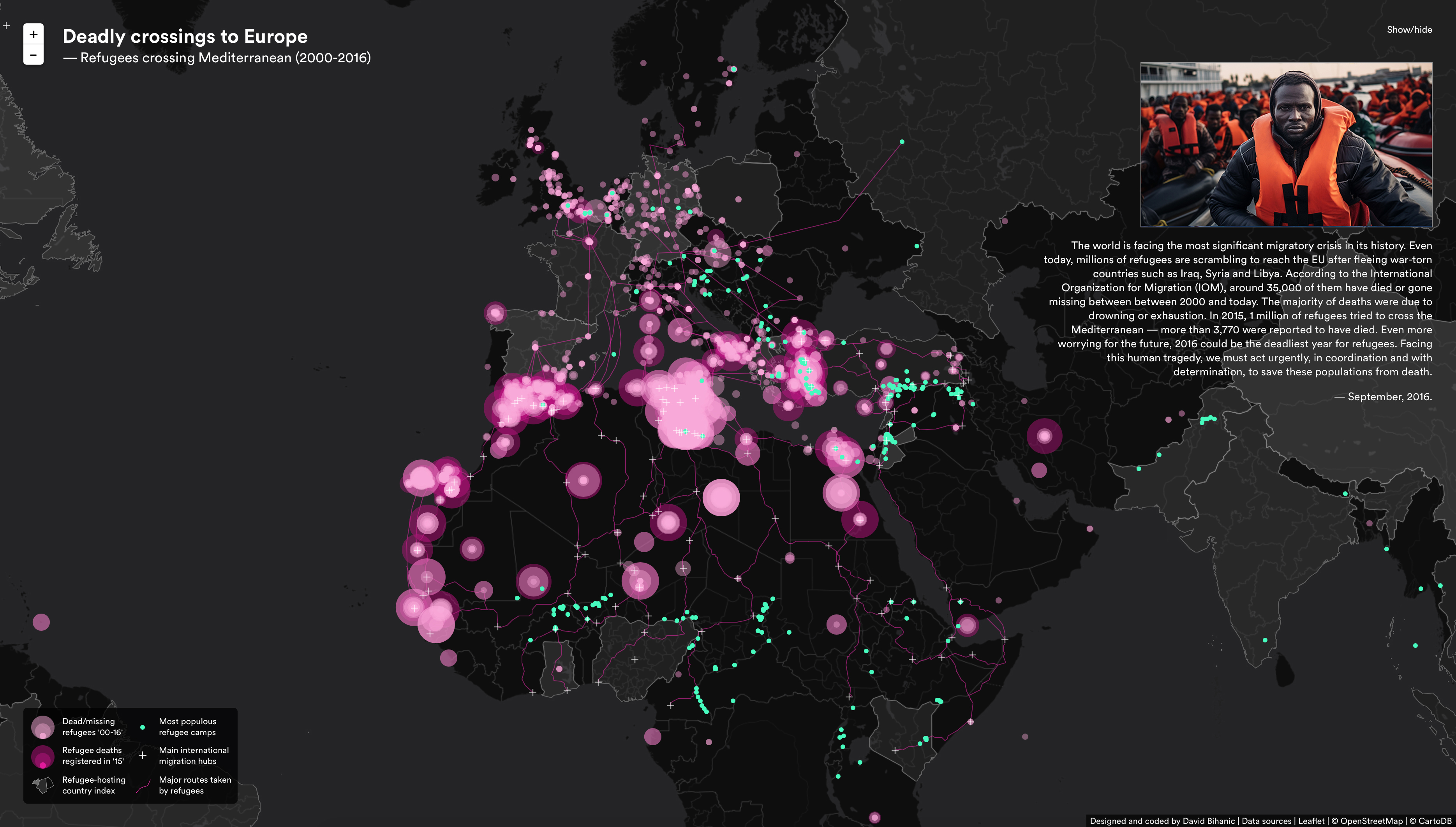
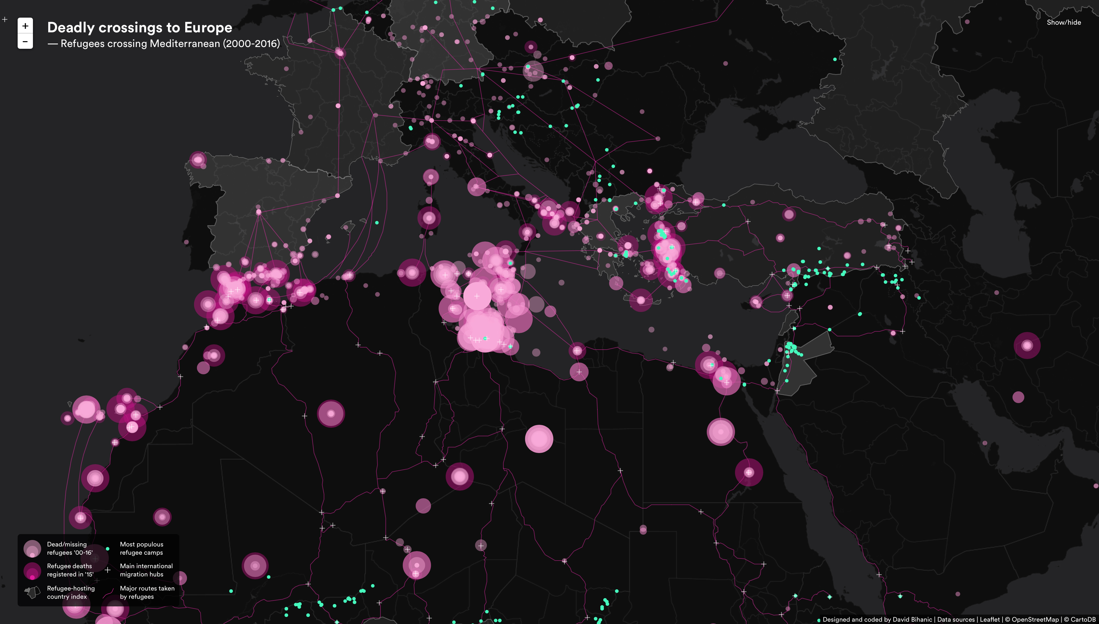
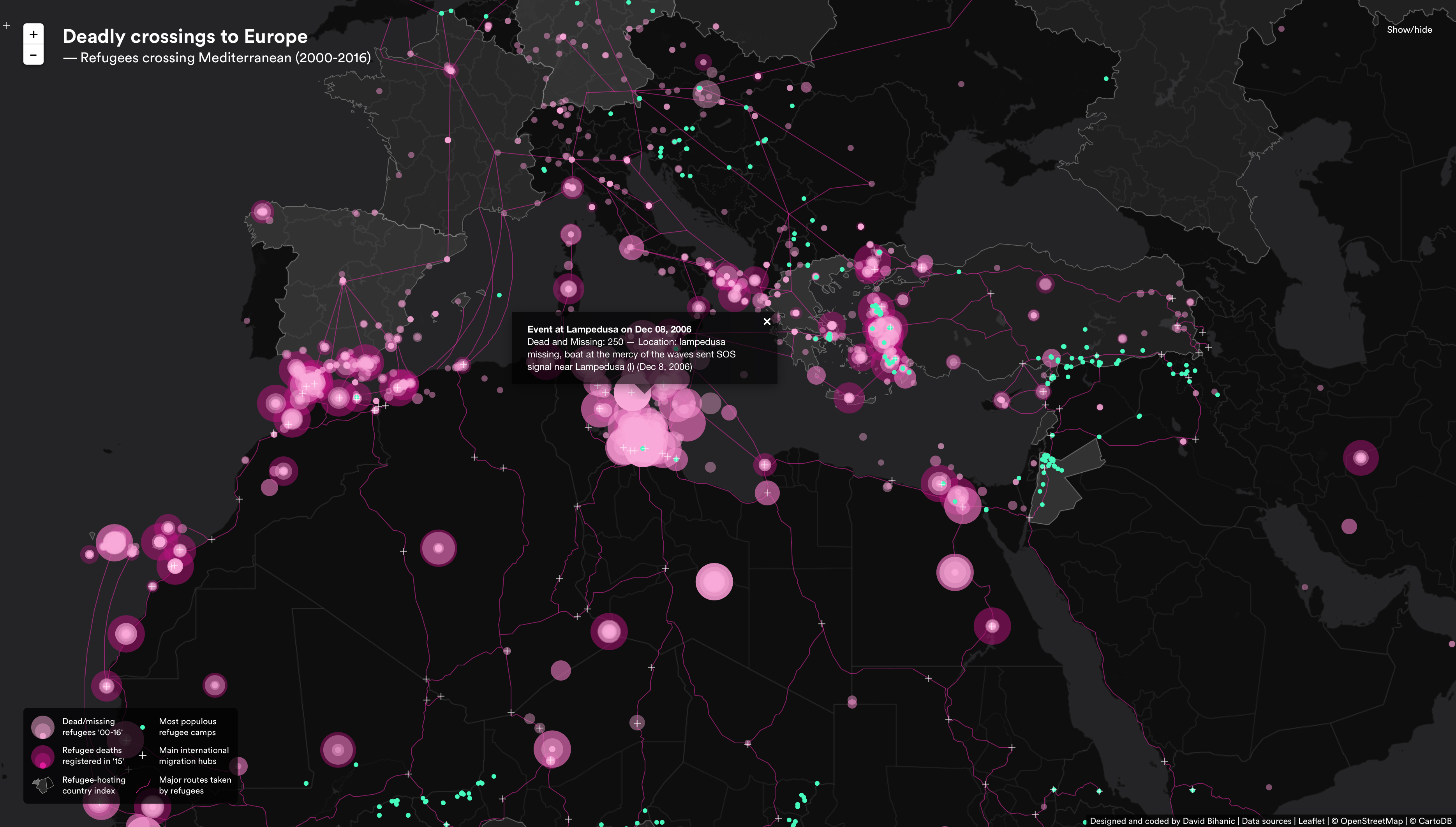
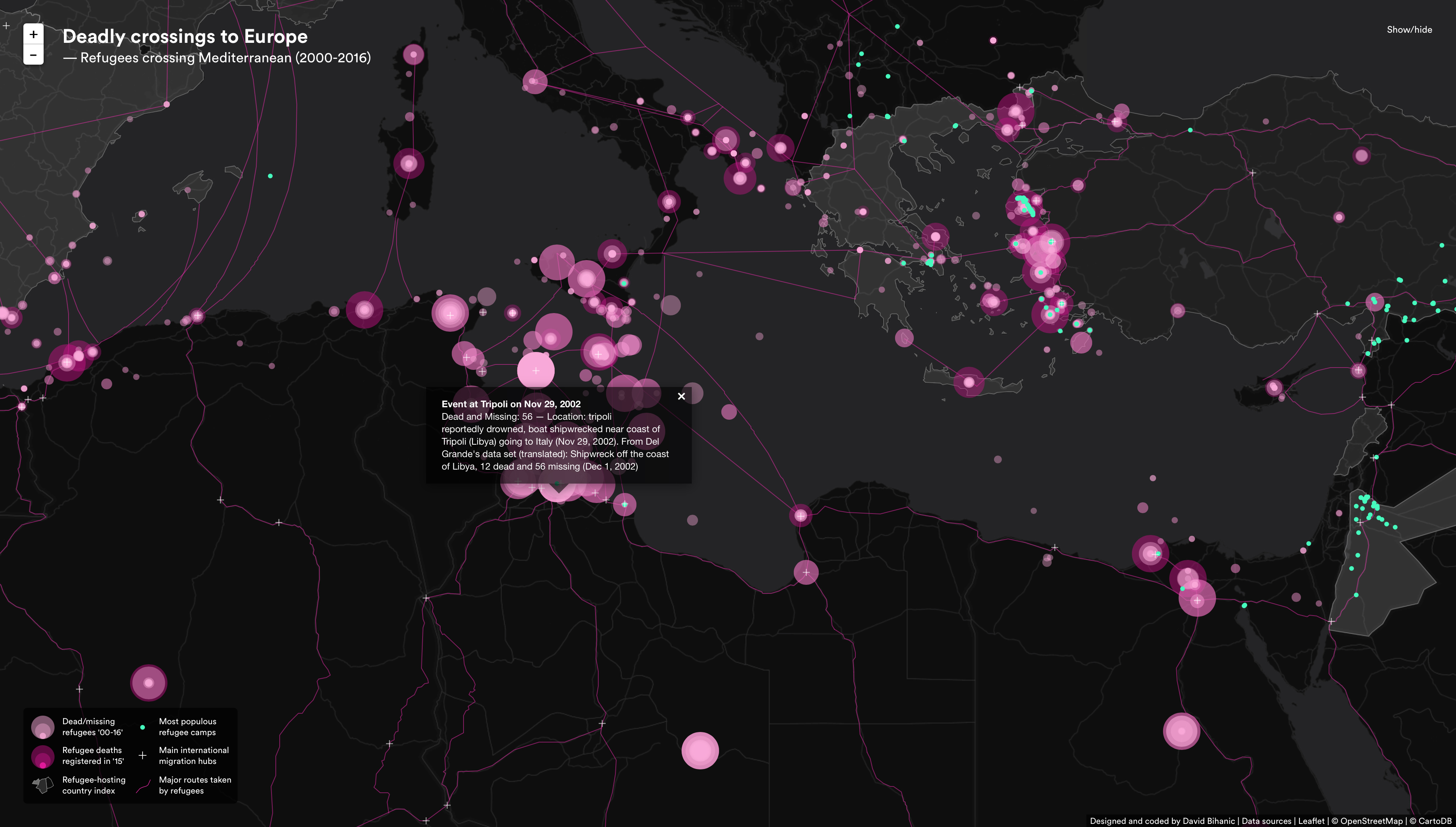
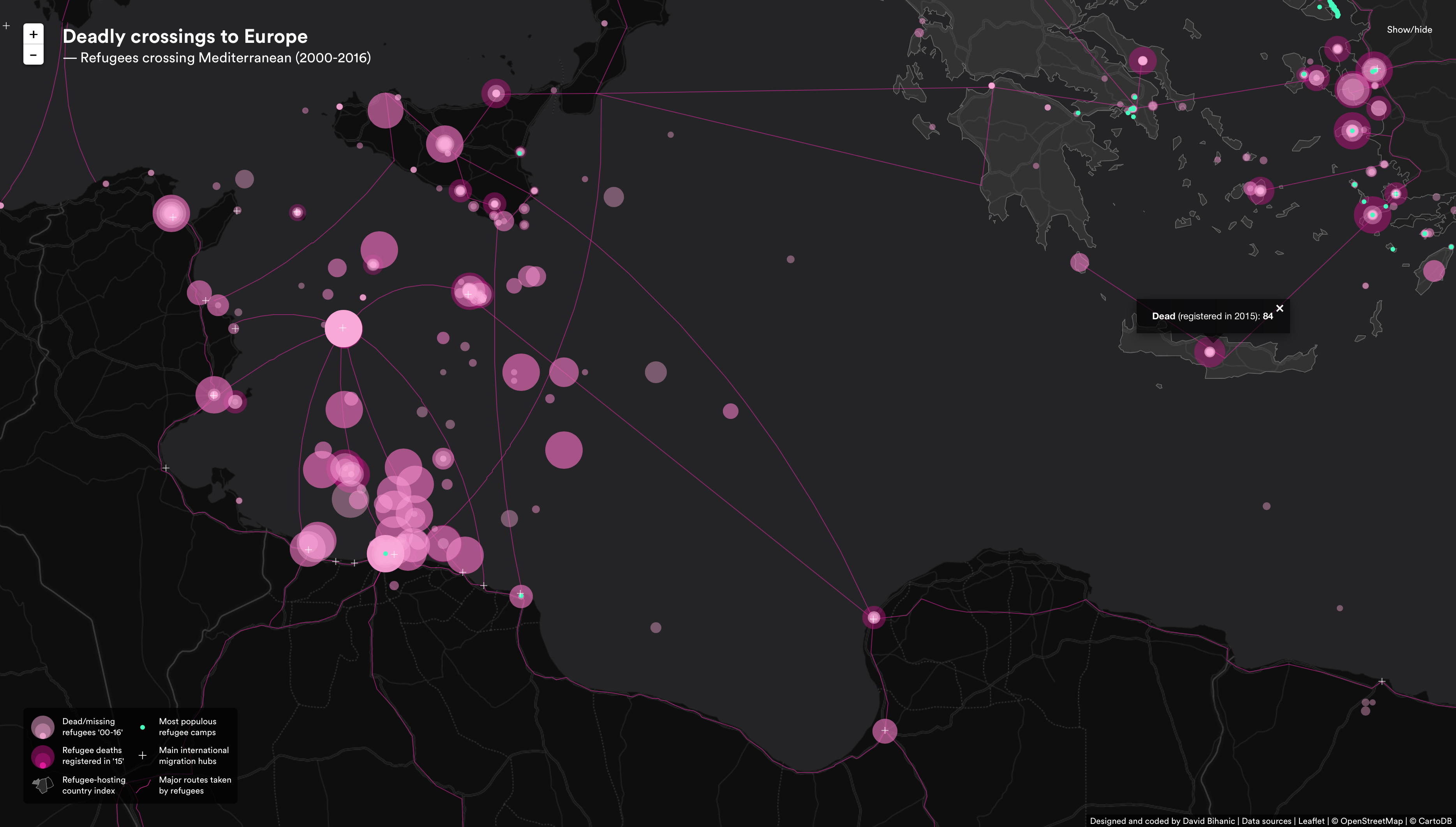
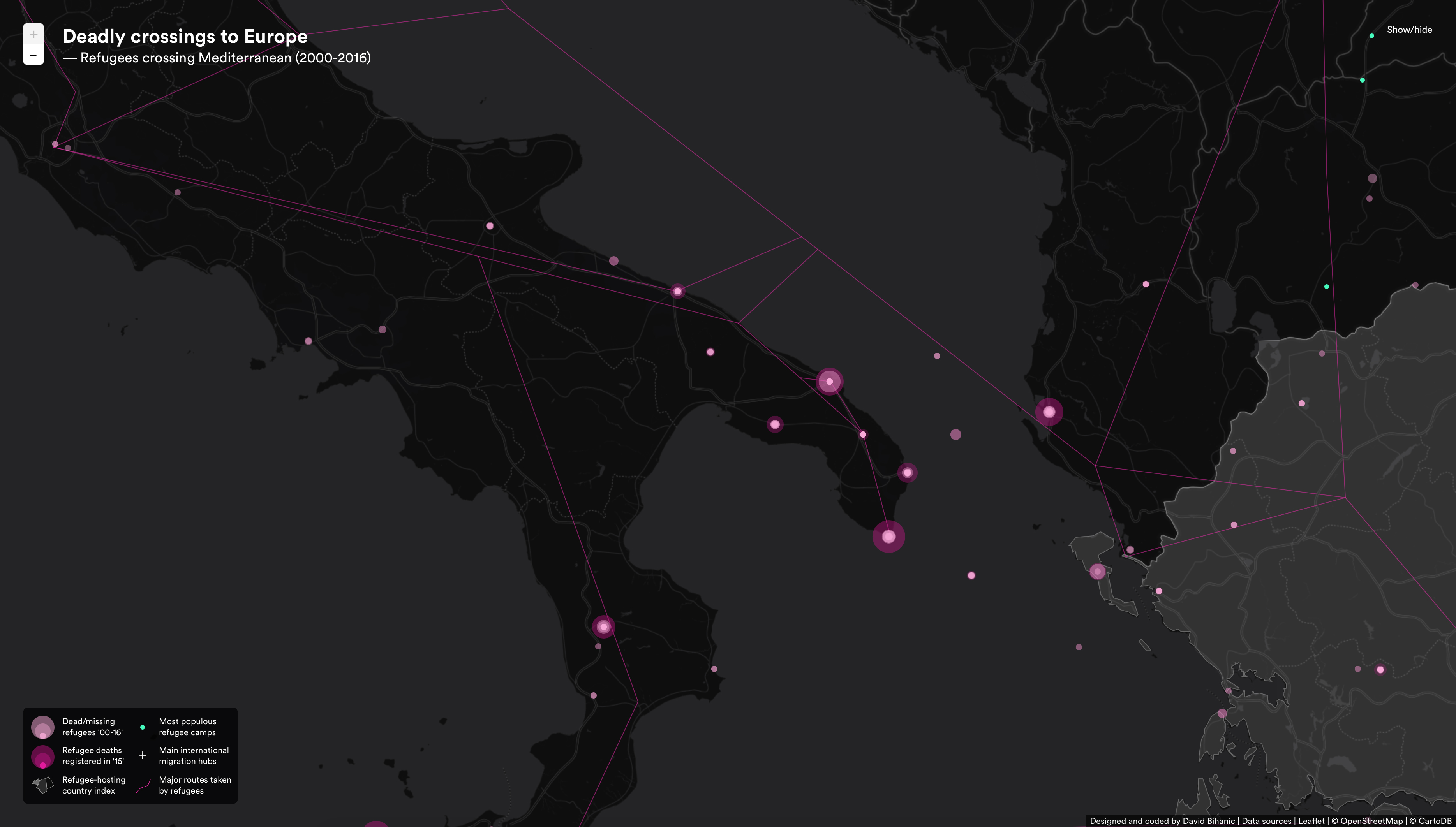
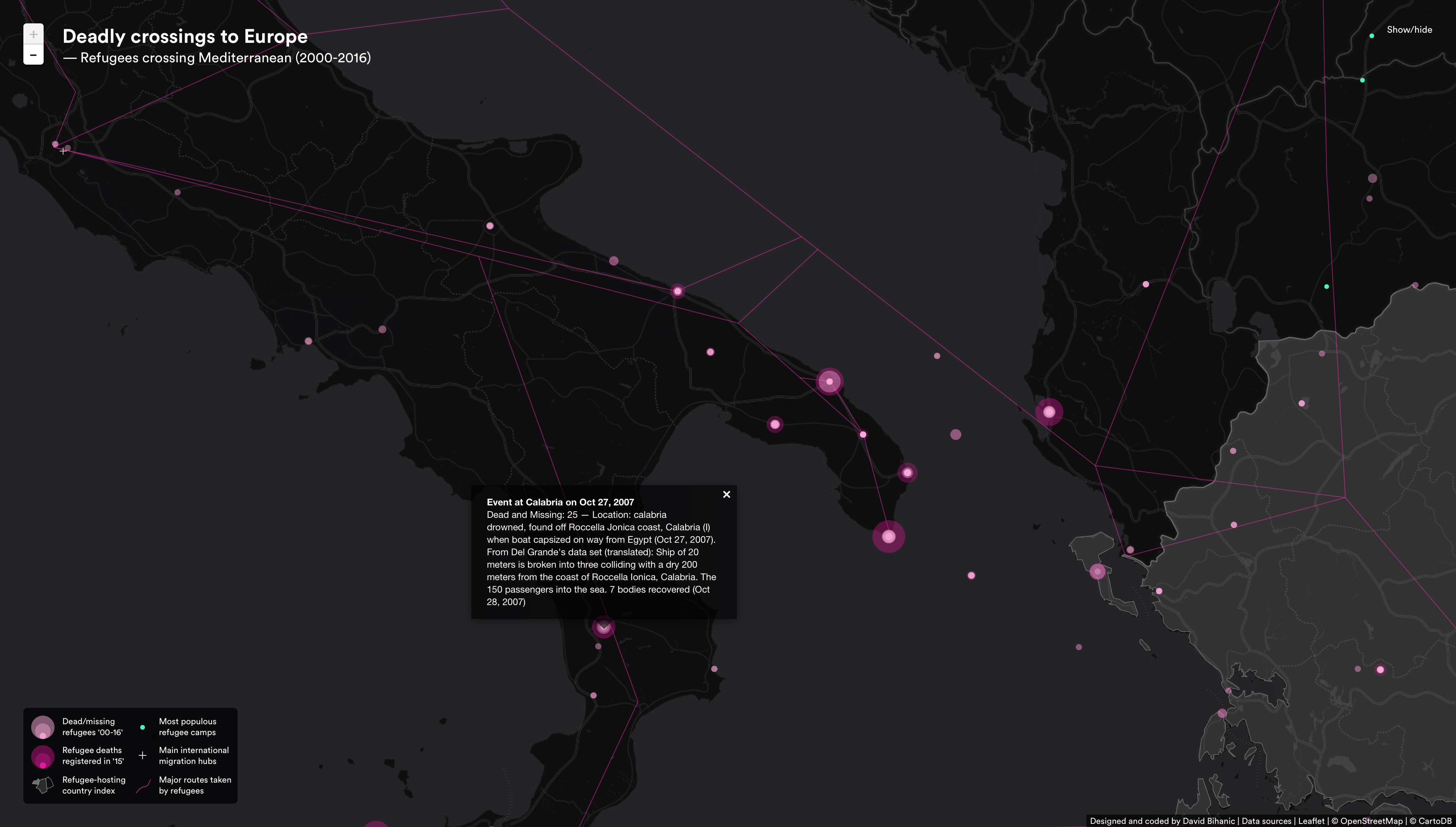
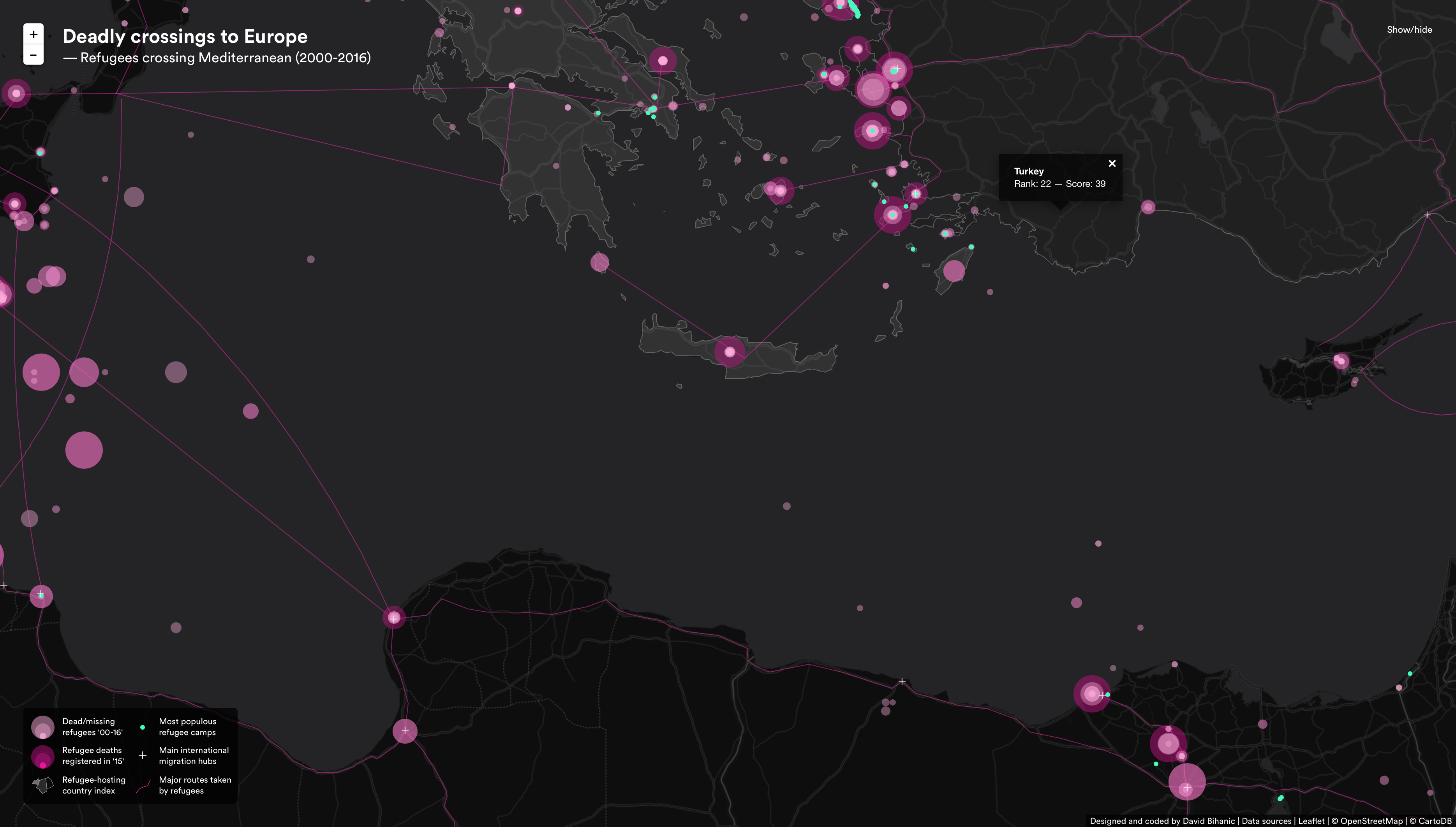
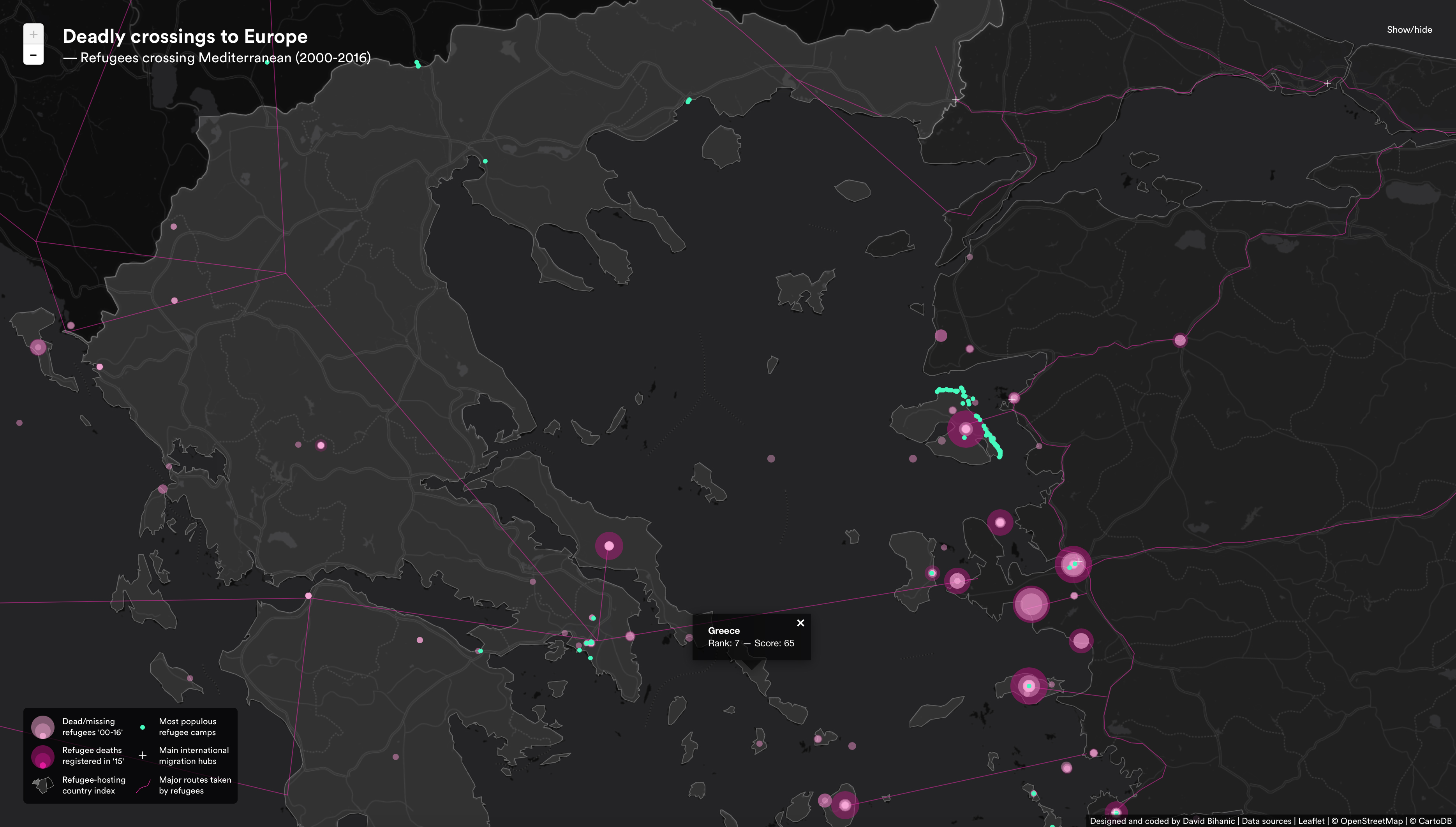
Screencast
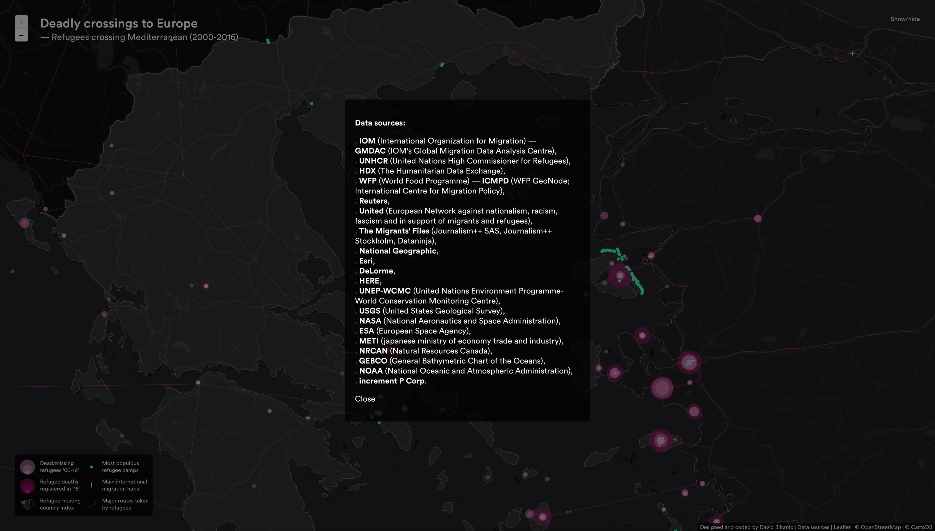
Data sources:
IOM (International Organization for Migration)—GMDAC (IOM’s Global Migration Data Analysis Centre), UNHCR (United Nations High Commissioner for Refugees), HDX (The Humanitarian Data Exchange), WFP(World Food Programme)—ICMPD (WFP GeoNode; International Centre for Migration Policy), Reuters, United (European Network against nationalism, racism, fascism and in support of migrants and refugees), The Migrants’ Files (Journalism++ SAS, Journalism++ Stockholm, Dataninja), National Geographic, Esri, DeLorme, HERE, UNEP-WCMC (United Nations Environment Programme-World Conservation Monitoring Centre), USGS (United States Geological Survey), NASA (National Aeronautics and Space Administration), ESA (European Space Agency), METI (japanese ministry of economy trade and industry), NRCAN (Natural Resources Canada), GEBCO (General Bathymetric Chart of the Oceans), NOAA (National Oceanic and Atmospheric Administration), increment P Corp.
This data visualization was designed and coded by David Bihanic (2016).
Conference presentation slides (in french)—”Where to find refuge today?” 25-year Symposium of the NGO SIF (an international Non Governmental solidarity Organization acting in the fields of humanitarian and development aid, in France and worldwide), Musée des confluences, May 17, 2017, Lyon.
Exhibition
* “Data Publics: Investigating the formation and representation of crowds, groups and clusters in digital economies”. Conference (speakers, workshop and exhibits) at Lancaster University, 31st March-2nd April, 2017 (http://datapublics.net / @datapublics / #datapublics) organized by Clara Crivellaro (Newcastle University), Joe Deville (Lancaster University), Daniel Richards (Lancaster University), Sebastian Weise (Newcastle University), and Louise Mullagh (Lancaster University / conference coordination and exhibition curation).
The conference was funded by the Digital Economy Network and the Data Science Institute (Lancaster University), with additional support from the Centre for Mobilities Research (Lancaster University), Imagination Lancaster, the EPSRC Centre for Doctoral Training in Digital Civics (Newcastle University), and the HighWire Centre for Doctoral Training (Lancaster University).
Download the program here
To mention: David Bihanic, “Deadly crossings to Europe. Refugees crossing Mediterranean Sea (2000-2016)”, September 2016. Retrieved from davidbihanic.com/refugees